Bir Tawil and the Red Sea: Historical Timeline of a Desert Anomaly
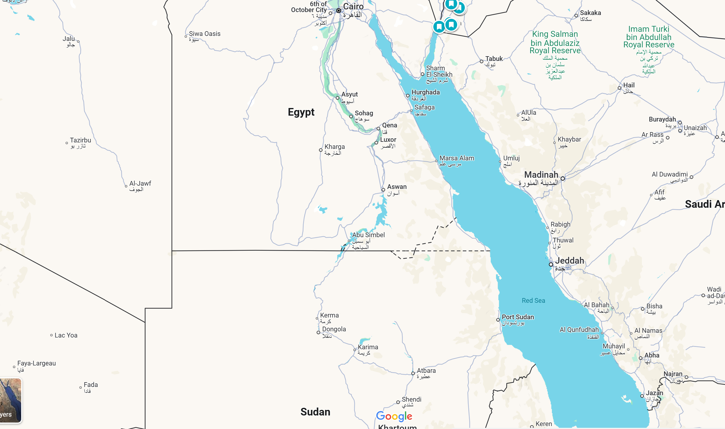
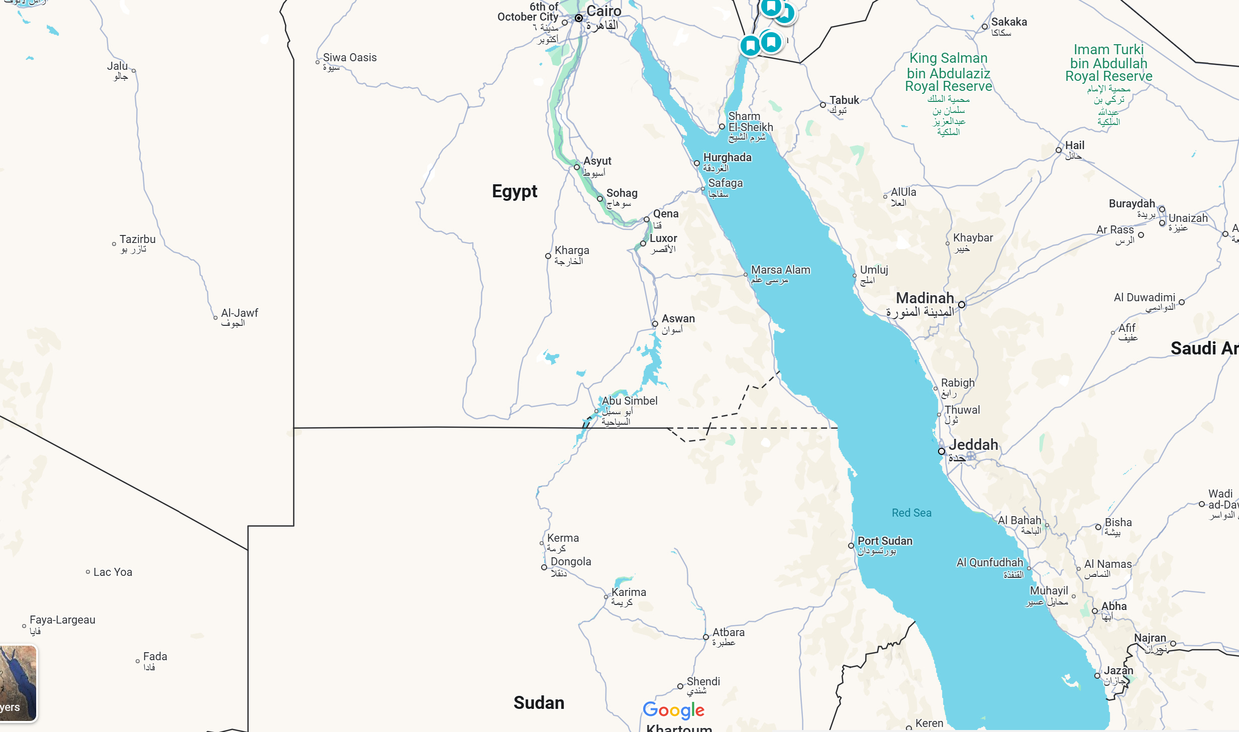
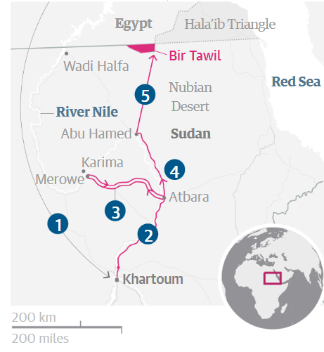
Deep in the eastern reaches of the Nubian Desert, an unpopulated trapezoid of rock and sand sits entirely abandoned by international diplomacy. Bir Tawil spans 2,060 square kilometers (roughly 795 square miles) along the frontier between Egypt and Sudan, yet neither nation includes it within its borders. While casual observers scanning digital maps often mistake it for a coastal territory, Bir Tawil is a strictly landlocked unclaimed territory. Its easternmost point sits roughly 100 statute miles, approximately 87 nautical miles (160 kilometers), inland from the strategic maritime waters of the Red Sea.
The desert enclave exists as the world’s only habitable terra nullius outside of Antarctica, created by an overlapping colonial administrative knot. As detailed in TheCollector Report examining sovereign territorial voids, Bir Tawil remains unclaimed precisely because claiming it would cost either nation a far more lucrative prize: the Hala'ib Triangle coastline. To understand why Bir Tawil remains marooned in the desert sands, one must untangle a legacy of British cartography, tribal migratory paths, and maritime geopolitics.
📌 Key Takeaways:
- The Coastal Buffer: Bir Tawil sits roughly 87 nautical miles (160 km) west of the Red Sea, separated from maritime waters by the contested Hala'ib Triangle.
- The Colonial Origin: A clash between the 1899 political boundary (22nd parallel north) and the 1902 administrative boundary created an inverted territorial paradox.
- The Zero-Sum Standoff: Under international law, claiming Bir Tawil requires forfeiting Hala'ib, leaving Bir Tawil deliberately rejected by both Cairo and Khartoum.
The Geography of Isolation: Measuring the Gap to the Coastline
Bir Tawil is defined by severe Nubian Desert geography. Its northern border runs along the 22nd parallel north for 95 kilometers (59 miles), while its southern boundary measures just 46 kilometers (29 miles). The territory narrows from north to south, carved out between barren mountains and gravel plateaus. At its southern tip rises Gabal Hagar El Zarqa elevation, reaching 662 meters above sea level. This peak anchors a landscape crisscrossed by dry wadis that receive virtually zero measurable rainfall for years at a time.
The shortest overland route from Bir Tawil's eastern boundary to the Red Sea runs directly through the rugged mountains of Jabal Elba before sloping downward toward Marsa Hala'ib. Navigating those 87 nautical miles requires crossing blistering terrain without paved infrastructure, permanent water sources, or border checkpoints. Because Bir Tawil has no coastline, it possesses no deep-water access, no exclusive economic zone (EEZ), and no legal rights to offshore mineral blocks.
That maritime absence defines its geopolitical worth. If Bir Tawil touched the Red Sea, Cairo and Khartoum would have resolved its status decades ago. Instead, it remains an arid island of sand surrounded by sovereign administration, cut off from oceanic trade routes by the very parcel of land that caused its abandonment.
How Two Colonial Treaties Created Terra Nullius North Africa
The origin of Bir Tawil’s isolation dates back to the British Empire's management of the Anglo-Egyptian Condominium. On January 19, 1899, Lord Cromer, Britain’s consul-general in Egypt, signed an agreement establishing the 1899 political boundary. This treaty drew a straight demarcation line directly along the 22nd parallel north, running from the Libyan border eastward to the Red Sea. Under this strict mathematical line, the Hala'ib Triangle sat north of the parallel inside Egypt, while Bir Tawil sat south of the parallel inside Sudan.
Three years later, British administrators realized the geometric line severed historical grazing patterns. On November 4, 1902, Britain established the 1902 administrative boundary, designed to match tribal realities on the ground:
- Pastoralists who grazed their herds across the northern Hala'ib area were placed under the jurisdiction of Khartoum.
- Based around Aswan, the Ababda tribe held ancestral grazing routes southward into Bir Tawil. The British placed Bir Tawil under Egyptian administration to preserve these family links.
- A small northward finger along the Nile was placed under Sudanese administration to keep riverine communities intact.
When Sudan gained independence in 1956, both governments published maps supporting conflicting legal instruments. Egypt recognized only the 1899 treaty, which awarded it the coastal Hala'ib Triangle while assigning Bir Tawil to Sudan. Sudan asserted the 1902 administrative border, which recognized its claim to Hala'ib while pushing Bir Tawil into Egypt. Consequently, Bir Tawil became true terra nullius North Africa, a territory rejected by both neighbors because claiming it would automatically invalidate their legal right to the coast.
The Hala'ib Stakes: Why Coastline Trumps Desert Sand
The territorial trade-off is fundamentally asymmetric. Bir Tawil measures 2,060 square kilometers of hyper-arid desert containing no permanent towns. By contrast, the Hala'ib Triangle spans 20,580 square kilometers, ten times larger, and controls more than 180 kilometers of Red Sea coastline.
Administered practically by Egypt's Red Sea Governorate since the mid-1990s, Hala'ib controls lucrative offshore fisheries, pristine coral reefs, potential maritime oil and natural gas basins, and major commercial shipping channels approaching the Suez Canal. Egypt maintains military installations, schools, roads, and civilian housing in Shalatin and Abu Ramad. Sudan continues to lodge annual protests with the United Nations Security Council, insisting that Hala'ib remains sovereign Sudanese territory under the 1902 administrative boundary.
| Territorial Metric | Bir Tawil (Unclaimed) | Hala'ib Triangle (Contested) |
|---|---|---|
| Total Surface Area | 2,060 km² (795 sq miles) | 20,580 km² (7,946 sq miles) |
| Maritime Access | None (100 miles inland) | 180+ km Red Sea shoreline |
| Primary International Treaty | 1899 Condominium (Sudan) / 1902 Admin (Egypt) | 1899 Condominium (Egypt) / 1902 Admin (Sudan) |
| Permanent Population | 0 (Transient nomads & miners only) | Estimated 10,000, 15,000 residents |
| Strategic Assets | Low-grade artisanal gold deposits | Deep-water ports, fisheries, offshore hydrocarbon potential |
Accepting sovereignty over Bir Tawil means abandoning legal ownership over the Hala'ib Triangle coastline. For Cairo, planting a flag in Bir Tawil would acknowledge the validity of the 1902 administrative adjustment, thereby handing Hala'ib to Sudan. For Khartoum, claiming Bir Tawil would require relying on the 1899 treaty, legally confirming Egypt’s sovereignty over Hala'ib. Bir Tawil’s status as a diplomatic orphan is the intentional price both nations pay to protect their coastal ambitions.
Bedouin Graziers and Gold Miners: Life Inside the Buffer
While cartographers describe Bir Tawil as completely empty, the territory is not devoid of human presence. For centuries, Ababda tribe ancestral grazing routes crossed these valleys. Camel herders still move through the wadis after rare seasonal downpours prompt sparse desert brush. These pastoralists do not identify with national borders drawn in European capitals; they cross the 22nd parallel following livestock feed and well sites.
Over the past decade, a quiet gold rush altered Bir Tawil's demographic rhythms. Artisanal miners from northern Sudan set up temporary, rough-and-tumble camps among the granite hills. Armed with cheap metal detectors, diesel generators, and rudimentary milling equipment, hundreds of prospectors dig unauthorized pits into dry riverbeds.
They operate in an institutional vacuum. Neither the Egyptian Armed Forces nor Sudanese police forces run patrols inside Bir Tawil's interior. Disputes between mining crews are settled through customary tribal councils (Urf) run by local Ababda and Bisharin elders. When supplies run dry, prospectors traverse southward toward Abu Hamad in Sudan rather than navigating the 100-mile mountain obstacle eastward to the Red Sea, cementing Bir Tawil's practical economic integration with the Nile valley rather than the coast.
Micronation Stunts and the Realities of International Law
Bir Tawil’s landlocked, unclaimed status attracts recurring waves of online eccentrics and self-proclaimed monarchs. In June 2014, an American named Jeremiah Heaton traveled to the region to plant a blue flag featuring four stars and a crown, declaring the "Kingdom of North Sudan" so his seven-year-old daughter could become an actual princess. Three years later, Indian entrepreneur Suyash Dixit drove into the desert, planted seedlings, and declared the "Kingdom of Dixit."
These declarations gain brief viral traction on social networks, but they hold zero legal validity. Under the Montevideo Convention on the Rights and Duties of States (1933), an entity must satisfy four criteria to qualify as a sovereign state:
- A permanent population
- A defined territory
- A government
- The capacity to enter into relations with other states
Planting a flag and taking a photograph establishes none of these elements. Neither the Egyptian government nor the United Nations recognizes any external micronation claims over Bir Tawil. Foreign visitors who attempt to reach the area must obtain military transit permits from Egyptian interior ministries or secure transit through Sudanese tribal routes. Travelers attempting unauthorized journeys without state clearance face detention, equipment confiscation, or immediate deportation by military outposts monitoring the perimeter.
Frequently Asked Questions (FAQ)
Q1: How far is Bir Tawil from the Red Sea in miles and kilometers?
A1: Bir Tawil is roughly 100 statute miles (160 kilometers) or 87 nautical miles inland from the Red Sea coast. The rugged mountains of the Hala'ib Triangle separate Bir Tawil from the shoreline.
Q2: Can an individual travel to Bir Tawil and claim it under international law?
A2: No. International law does not permit individuals to claim sovereignty over land via discovery or occupation. The Montevideo Convention requires a permanent population, civil administration, and international recognition, none of which micronation hobbyists possess.
Q3: Why doesn't Egypt or Sudan simply split Bir Tawil down the middle?
A3: Dividing Bir Tawil would require negotiating a brand-new bilateral boundary agreement, which would force both nations to officially settle their overlapping claims to the Hala'ib Triangle. Neither capital is willing to compromise its coastal claim along the Red Sea.
The Permanent Deadlock Along the 22nd Parallel
Bir Tawil remains stranded in sovereign limbo because the cost of resolving its status far outweighs any economic benefit it might offer. With no maritime access, no permanent water infrastructure, and a punishing desert climate, the territory offers nothing that justifies surrendering a single mile of Red Sea coastline.
As long as the Egypt Sudan border dispute remains unresolved, Bir Tawil will stay exactly what colonial administrators made it more than a century ago: an arid, landlocked expanse of sand where no nation wants to plant its flag.


