The Complete Cape Verde Guide: Location, Capital, Travel, and Rise in World Football
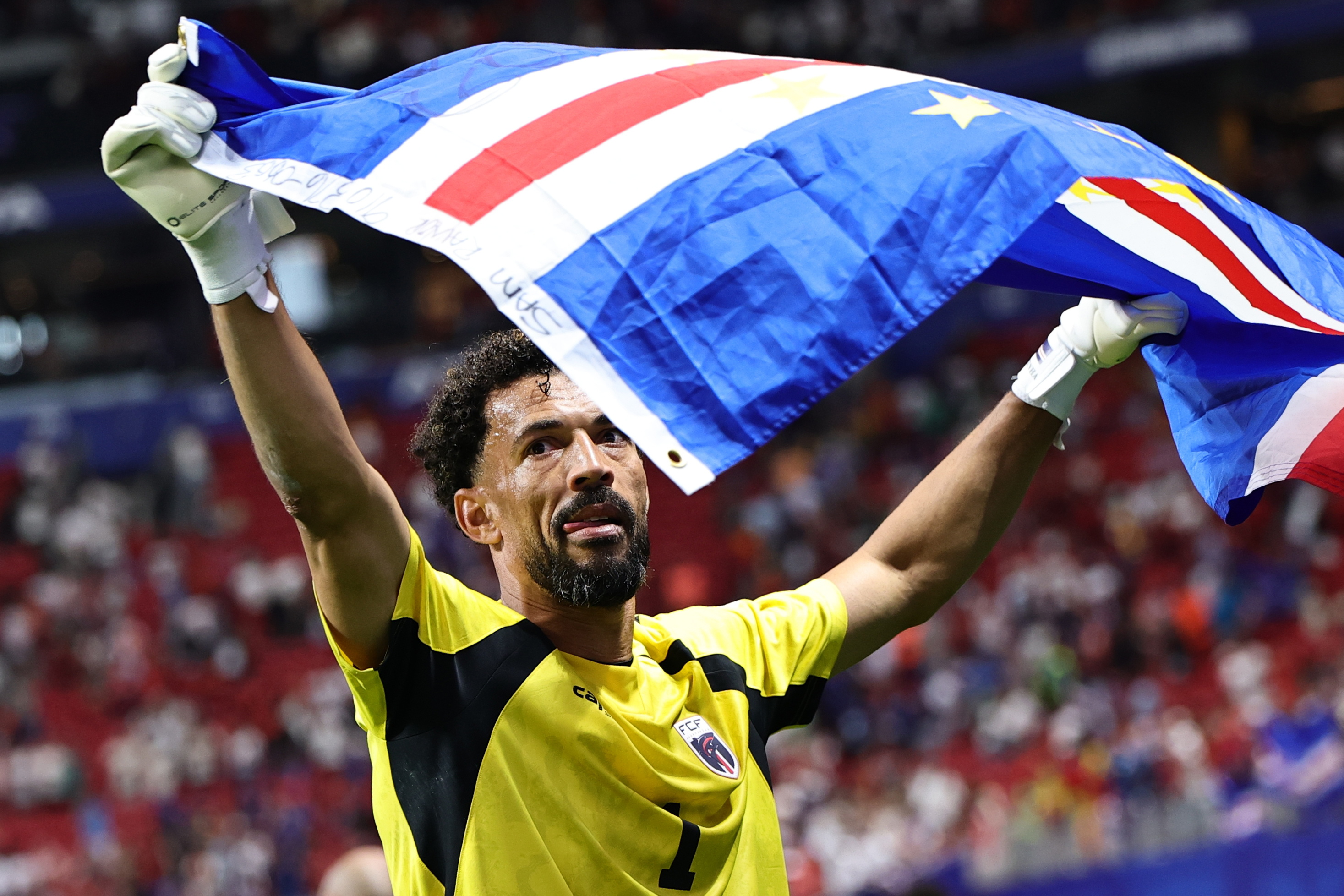
When millions of football fans watched the national team of Cape Verde push reigning champions Argentina to the limit on July 3, 2026, search engines lit up with a singular, urgent question in multiple languages: Where is Cabo Verde? The tiny island nation, dubbed the breakout team of the 2026 tournament, suddenly commanded global attention. As chronicled in the Prensa Libre Report, inquiries surrounding the country's population, language, and geography skyrocketed as spectators scrambled to understand how an isolated group of Atlantic islands could produce an international sports sensation.
Beyond the football pitch, Cape Verde, officially the Republic of Cabo Verde, occupies an extraordinary geographical and cultural crossroads. It sits far off the West African coastline, positioned where the Atlantic trade winds blow Sahara sands straight across turquoise reefs. Long known to European winter sun-seekers and lovers of acoustic folk music, this volcanic nation is stepping into a broader international spotlight.
📌 Key Takeaways:
- Geographic Location: Cape Verde is an Atlantic Ocean archipelago situated roughly 570 kilometers (350 miles) off the western coast of Senegal, forming the southernmost cluster of the Macaronesia island group.
- The Land: The nation consists of 10 volcanic islands (nine of which are inhabited) divided into the northern Barlavento (windward) and southern Sotavento (leeward) chains, anchored by the capital city of Praia on Santiago.
- Language and People: While Portuguese remains the official language for government and education, Cape Verdean Creole (Kriolu) is the mother tongue spoken across a domestic population of roughly 525,000 residents.
- Cultural Identity: World-renowned for its soul-stirring Morna musical heritage and volcanic landscapes, the country blends African roots and Portuguese colonial history into a distinct, stable democracy.
The World Cup Breakthrough That Put an Atlantic Outpost on the Global Map
International sports have a habit of redrawing mental maps. For decades, Cape Verde lingered as an obscure dot on schoolroom globes, known mainly to Portuguese travelers, maritime shipping navigators, and fans of world music pioneer Cesária Évora. That shifted dramatically during the 2026 World Cup. The Tubarões Azuis (Blue Sharks) fought their way into the knockout stages, capturing global imagination through sheer discipline and collective grit before bowing out against Argentina.
The sporting run ignited immense curiosity. Millions of casual observers assumed Cape Verde was either an enclave in continental Africa or an obscure Caribbean dependency. Instead, they discovered a sovereign nation with roughly 525,000 citizens at home and an even larger diaspora spread across Boston, Rotterdam, and Lisbon. The team's roster mirrored this unique migratory pattern: players born on the islands played side-by-side with descendants from the diaspora, embodying the country's global reach.
The moment shattered outdated perceptions. Cape Verde proved it could not be relegated to a footnote of colonial history or viewed merely as a remote beach resort. It announced itself as a confident, culturally distinct republic capable of commanding the world stage.
Pinpointing the Archipelago: Coordinates, Borders, and the Macaronesia Chain
To find Cape Verde on an Atlantic Ocean map, trace westward from Dakar, Senegal. Approximately 570 kilometers into open ocean, between latitudes 14° and 18° N, lies an arc of jagged volcanic peaks emerging from deep water. Its maritime borders border Senegal, The Gambia, and Mauritania to the east, though no land bridges or shallow shelves connect them. Cape Verde rises directly from the seabed.
Biogeographically, the archipelago forms the southern anchor of Macaronesia, a group of four North Atlantic island territories that also includes the Azores, Madeira, and the Canary Islands. While the northern Macaronesian islands remain under Portuguese and Spanish sovereignty, Cape Verde gained full independence from Portugal on July 5, 1975.
The archipelago's geography creates a striking meteorological divide. Positioned directly in the path of the Harmattan, a dry, dusty trade wind sweeping out of the Sahara Desert, the eastern islands resemble windswept extensions of the African mainland. Conversely, the western volcanic peaks catch Atlantic moisture, producing microclimates ranging from barren desert dunes to lush cloud forests and terraced mountain valleys.
The Ten Volcanic Islands: Dividing Barlavento and Sotavento
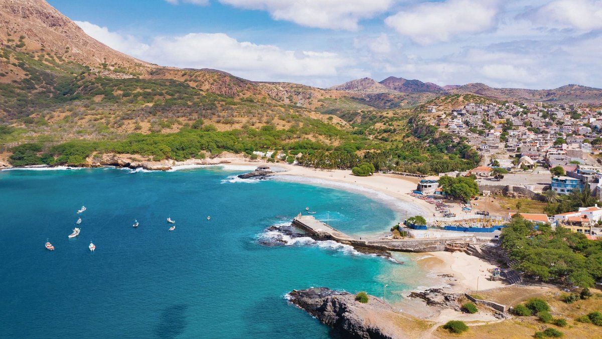
Cape Verde spans 4,033 square kilometers across 10 islands and several uninhabited islets. Geographers split the nation into two distinct chains based on prevailing trade winds: the Barlavento (Windward) group to the north and the Sotavento (Leeward) group to the south. Each island functions almost as an independent ecosystem, displaying vastly different topography, climate, and daily rhythms.
| Island | Group | Distinctive Landscape & Character | Primary Role |
|---|---|---|---|
| Santiago | Sotavento | Verdant valleys, jagged peaks, historic fortresses | Seat of government; home to Praia and Cidade Velha |
| São Vicente | Barlavento | Deep natural harbor, arid hills, Mindelo harbor bay | Cultural hub, live music venues, annual Carnival |
| Sal | Barlavento | Flat salt flats, golden sandy shores, turquoise water | Major resort hub, international charter flight gate |
| Boa Vista | Barlavento | Sprawling desert sand dunes, 55 km of pristine coast | Ecotourism, marine turtle nesting, watersports |
| Fogo | Sotavento | Active stratovolcano (Pico do Fogo), black lava fields | High-altitude viticulture, coffee, adventure hiking |
| Santo Antão | Barlavento | Sheer basalt canyons, lush tropical ribeiras, terraces | Trekking trails, agriculture, artisan grogue rum |
The remaining inhabited islands, São Nicolau, Brava, and Maio, remain quiet, rural sanctuaries largely bypassed by mass resort developers. Santa Luzia, in the northern group, stands completely uninhabited, preserved as a rugged maritime nature reserve.
Language, People, and Soul: Beyond Portuguese to Cape Verdean Creole
Understanding Cape Verde requires looking beyond standard demographic profiles. Portuguese remains the sole official language of administration, law, and formal education. Walk through the bustling streets of Praia or the harbor markets of Mindelo, however, and you will rarely hear standard European Portuguese spoken among friends.
The true vernacular is Kriolu (Cape Verdean Creole), recognized as the oldest Portuguese-based creole language in the world. Developed during the 15th and 16th centuries when enslaved Africans from diverse linguistic groups interacted with Portuguese settlers, Kriolu evolved its own sophisticated grammar, vocabulary, and distinct regional dialects. While long confined to oral tradition, Kriolu enjoys growing institutional recognition, with national initiatives pushing for its standardization and co-official status.
This linguistic synthesis mirrors Cape Verde’s social fabric. The population of roughly 525,000 is predominantly mestiço (creole), blending West African and Southern European ancestry.
Culturally, this history crystalizes in music. The nation’s signature genre is Morna, an acoustic, melancholic style sung in Kriolu that received UNESCO Intangible Cultural Heritage status in 2019. Driven by classical guitar, cavaquinho, accordion, and violin, Morna captures sodade, an untranslatable sense of longing, separation, and sorrow born from centuries of forced migration and maritime isolation. Alongside livelier rhythms like Funaná and Coladeira, music serves as the collective spine of Cape Verdean daily life.
Navigating Travel Realities Across the Islands
Travel to Cape Verde has matured substantially, yet it presents logistical realities that surprise unprepared visitors. The country does not function as a single contiguous destination; island-hopping requires deliberate planning.
Sal and Boa Vista handle the vast majority of international holiday traffic. Blessed with extensive coastlines, these flat eastern islands house large all-inclusive beach properties catering to sunbathers, kitesurfers, and windsurfers. English, French, and German are widely understood across resort strips.
Travelers seeking cultural depth or mountain landscapes head elsewhere. Santiago offers the country's deepest historical landmarks, notably Cidade Velha, the first European colonial settlement in the tropics, established in 1462. Santo Antão, accessible only by a one-hour ferry from São Vicente, features some of the most dramatic mountain trekking paths in the Atlantic basin, with mule trails clinging to sheer volcanic precipices.
Domestic movement between the islands relies on regional flights operated by local carriers and intermittent ferry lines. Inter-island flights can experience seasonal schedule changes when coastal winds kick up Sahara dust storms between December and March. Travelers planning multi-island itineraries need built-in flexibility rather than tight, rigid connections.
Economic Resilience and Democratic Stability in West Africa
In a regional neighborhood often challenged by governance crises and military turbulence, Cape Verde stands out as one of Africa's most enduring success stories. Since adopting multiparty democracy in 1991, the republic has staged peaceful transitions of power, solidifying its place atop international rankings for press freedom, civil liberties, and human rights in Africa.
The country operates with almost no mineral wealth or fossil fuel reserves. Freshwater scarcity remains a perpetual challenge, requiring extensive desalination operations powered by growing wind and solar infrastructure. The national economy relies primarily on services, tourism, shipping logistics, and critical financial remittances sent home by diaspora communities residing abroad.
By leveraging its strategic maritime location along Atlantic shipping corridors connecting Africa, Europe, and the Americas, Cape Verde continues to expand its ports and renewable energy capacity. It maintains close ties with both the African Union and the European Union, enjoying a unique "Special Partnership" status with the EU that fosters trade and security collaboration.
Frequently Asked Questions (FAQ)
Where is Cape Verde located in relation to mainland Africa?
Cape Verde is an Atlantic Ocean archipelago located approximately 570 kilometers (350 miles) off the coast of Senegal in West Africa. It sits directly west of the Cap-Vert peninsula, Dakar's westernmost tip.
What is the capital city of Cape Verde?
The capital city is Praia, located on the southern coast of Santiago Island. Praia serves as the political, administrative, and diplomatic center of the nation.
What languages do travelers need to speak when visiting?
While Portuguese is the official language for government and business, the population speaks Cape Verdean Creole (Kriolu) in daily life. In major resort areas on Sal and Boa Vista, hospitality staff frequently speak English, French, and Italian.
Do tourists need a visa to enter Cape Verde?
Citizens from the European Union, the United Kingdom, the United States, Canada, and several other nations can enter Cape Verde visa-free for stays up to 30 to 90 days. Most foreign visitors must complete an online pre-arrival registration (EASE) and pay an Airport Security Tax (TSA) prior to landing.
How many islands can you actually visit?
Cape Verde has nine inhabited islands open to visitors: Santiago, São Vicente, Santo Antão, Fogo, Sal, Boa Vista, São Nicolau, Maio, and Brava. Most itineraries focus on two or three islands connected via short domestic flights or ferry routes.
An Atlantic Crossroads Stepping Firmly Onto the Global Stage
Cape Verde's unexpected run at the 2026 World Cup did more than rattle football powerhouses; it permanently altered how the world locates and understands this Atlantic nation. The sudden surge in curious searches exposed international audiences to an archipelago that defies easy categorization.
Neither entirely defined by its African geography nor confined to its European colonial heritage, Cape Verde thrives on its own terms. Its volcanic peaks, dry trade winds, and deep-seated traditions of hospitality, known locally as morabeza, reflect a society forged by resilience. Whether viewed as an emerging travel destination, a model of political stability, or a football underdog capable of testing giants, Cape Verde has moved from the geographic margins directly into the international spotlight.