How Accurate Is Flightradar24? Fact-Checking Radar 24 Plane Tracking Data in Crisis Situations
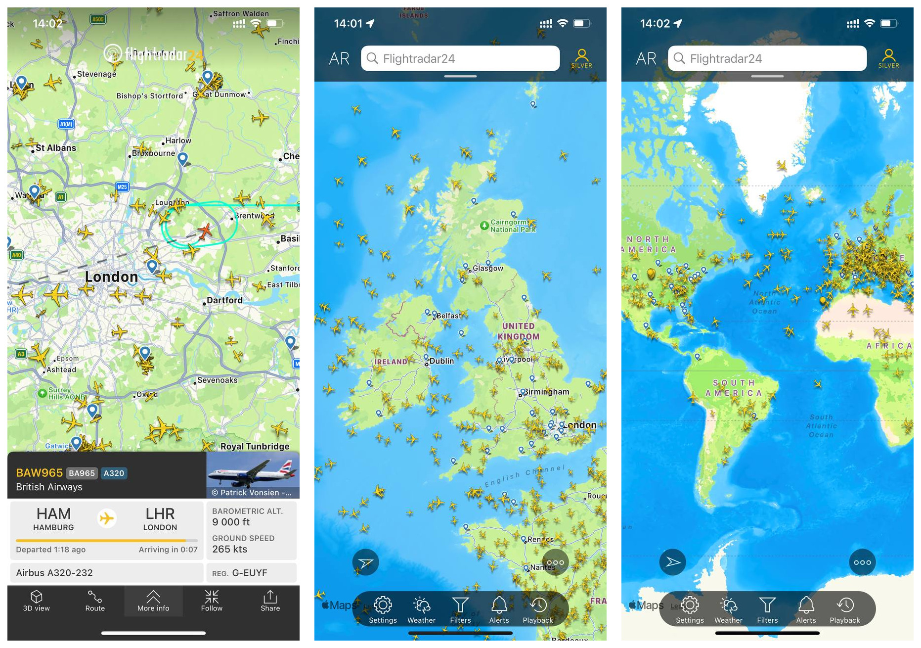
When an airliner triggers a squawk 7700 emergency broadcast or abruptly drops from cruising altitude, millions of internet users instantly descend on a single screen. Crowdsourced radar 24 plane tracking has turned aviation monitoring from an obscure, specialist hobby into a high-stakes public spectacle. As documented in a recent Flightradar24 Report detailing sudden surges in system traffic, flight path telemetry now commands headline news during severe weather events, airspace closures, and emergency diversions.
Yet commercial flight tracking services were never built to serve as black-box air crash investigation suites. During critical seconds when transponders cut out over open water, or when military operations darken local airspace, the gap between what users see on a live flight tracking map and what air traffic controllers view on professional scopes can produce widespread confusion and viral misinformation.
📌 Key Takeaways:
- Data Reliance: Flightradar24 relies on consumer-hosted ADS-B receivers and MLAT calculations rather than certified primary radar, leaving tracking blind when transponders cut power.
- Crisis Distortion: Dead reckoning algorithms project linear flight paths for up to several minutes after transponder signal loss, frequently producing false "crash dives" on consumer screens.
- Military Exceptions: National air forces regularly shut off Mode-S/ADS-B transponders during tactical movements, triggering unfounded rumors of system-wide tracking blackouts.
The Crowdsourced Network Powering ADS-B Transponder Data
The vast majority of modern consumer flight tracking does not use traditional radar spinning on an airfield tower. Instead, platforms like Flightradar24 depend on Automatic Dependent Surveillance-Broadcast (ADS-B). Aircraft determine their precise satellite position using GPS and periodically broadcast this coordinate data over unencrypted 1090 MHz radio frequencies alongside altitude, airspeed, and heading.
To ingest these signals, Flightradar24 coordinates a worldwide network exceeding 40,000 ground-based receiver kits, largely maintained by volunteers and aviation spotters. When an aircraft flies within line-of-sight, typically 150 to 250 nautical miles depending on receiver elevation and surrounding terrain, the ground unit captures the unencrypted bursts and relays them via domestic internet connections to central servers.
Where raw ADS-B transponder data is missing because older planes lack modernized avionics, the network deploys Multilateration (MLAT) tracking technology. By measuring the minute time difference of arrival (TDOA) of transponder signals across at least four separate ground receivers, server arrays compute the plane’s coordinates mathematically. While remarkably effective over dense urban areas, MLAT degrades sharply once an aircraft drifts past the overlapping coverage perimeter of terrestrial ground stations.
How the Platform Handles Squawk 7700 Emergencies and Disasters
When an aircrew dials transponder code 7700, indicating a general inflight emergency, the notification instantly flashes across user interfaces, often sending tens of thousands of concurrent viewers to a single tail number. At this point, Flightradar24 accuracy comes under direct scrutiny. The platform presents real-time flight status telemetry, but its response to acute distress scenarios reveals systemic technical limitations.
If an aircraft suffers rapid electrical bus failure, mid-air structural breakup, or enters a high-angle spiral toward ground level, the transponder transmission path breaks immediately. The receiver network stops logging data packets. Instead of dropping the icon instantly from the interface, the mapping engine frequently executes a dead reckoning projection.
During these brief intervals, the visualization system projects the plane forward along its last-logged speed and descent vector for up to 120 to 240 seconds before labeling the flight disconnected. In catastrophic dives, this latency can draw an artificial trajectory that dives straight into terrain miles away from the true wreckage field, leading online onlookers to broadcast unverified crash locations hours before official search-and-rescue teams deploy.
ATC Primary Radar vs ADS-B: Technical Breakdown and Limits
Public discourse routinely conflates civilian crowdsourced platforms with certified Air Traffic Control (ATC) facilities. The operational differences between these two monitoring architectures dictate what information can, and cannot, be verified during an incident.
| Surveillance Technology | Signal Origin | Update Frequency | Operational Weakness |
|---|---|---|---|
| Consumer ADS-B | Aircraft onboard GPS and 1090 MHz broadcast | 0.5, 2.0 seconds | Blind beyond ground receiver line-of-sight; fails if power cuts |
| Space-Based ADS-B | Low-Earth orbit satellite constellations (e.g., Iridium) | 1.0, 8.0 seconds | Subscription latency; commercial feeds lag official ATC satellite pipes |
| ATC Primary Radar (PSR) | Direct radio wave reflection off aircraft fuselage | 4.0, 12.0 seconds | Expensive ground maintenance; limited coverage over oceans |
| Multilateration (MLAT) | Time-difference calculation from Mode-S transponders | Variable (2.0, 10.0 seconds) | Requires at least 4 overlapping ground stations; inaccurate at low altitudes |
Primary radar sends electromagnetic energy into the sky and listens for physical reflections bouncing off metal structures. It requires zero cooperation from the aircraft. If pilots shut off every switch in the cockpit, primary radar still registers a return. In contrast, crowdsourced web services have no direct access to primary military or civil radar feeds. The moment transponder output ceases, crowdsourced monitoring collapses into an absolute coverage void.

Military Aircraft Transponder Shutoffs and Coverage Dead Zones
Misinterpretations of commercial flight tracking reach peak intensity during geopolitical flare-ups. Claims regularly circulate alleging that major air arms have blanket-disabled their fleets. In early 2026, fact-checking monitors scrutinized widespread rumors claiming the U.S. Air Force had permanently disabled flight tracking transponders across transport and patrol wings worldwide. Investigations by outlets including Misbar confirmed that while standard military doctrine allows selective shutoff during training drills or operational missions, no sweeping, unannounced transponder embargo occurred.
Military assets frequently disable Mode-S and ADS-B emissions to protect operational security. When an RC-135 reconnaissance airframe or strategic transport turns off its transponder along an active corridor, the aircraft seems to dematerialize from consumer maps. In reality, national air traffic control continues tracking the airframe using primary military surveillance arrays.
Natural geographic constraints compound this visibility gap. Vast oceanic sectors, such as the South Atlantic, central Pacific, and sub-Saharan zones, form extensive radar coverage dead zones. While airport arrival and departure feeds for major hubs like Cape Town International Airport (CPT) and Johannesburg Lanseria International (HLA) display fluid, continuous movements thanks to suburban receiver density, flights tracking north over remote land corridors often experience signal dropout. When planes transit regions without local host receivers, their visual tracks simply pause until a nearby receiver catches the next burst.
Rerouting Networks and Airline Recovery Operations
The true operational utility of crowdsourced flight platforms lies not in accident recreation, but in tracking macro-level airline recovery operations and network disruptions. When violent weather fronts batter major connecting airports, or when geopolitical tensions close international corridors overnight, commercial flight paths twist across entire continents.
During sweeping winter storms or severe convective weather across North America and Europe, dispatch centers redirect hundreds of routes simultaneously. Dispatchers and ground handlers monitor regional congestion using combined terrestrial ADS-B and airport gate feeds to anticipate arrival banks. When planes burn holding patterns, Flightradar24 displays racetrack loops and fuel-diversion vectors in crisp real time, providing travelers with ground-truth updates hours ahead of delayed airline customer service notifications.
Airline operations control centers (OCCs) routinely balance slot availability by watching secondary diversion hubs. If severe crosswinds shut primary runways at Cape Town, flights divert inward toward Lanseria or OR Tambo. Tracking platforms ingest slot delays and tail assignments, capturing the logistical ripple effect as grounded crews exceed legal duty times and aircraft reposition across continental networks.
Frequently Asked Questions (FAQ)
Q1: Why did a plane on Flightradar24 plunge straight down before disappearing?
A1: This is almost always an artifact of dead reckoning algorithms rather than an actual vertical dive. If an aircraft’s transponder loses power or drops below receiver terrain coverage, the tracking software projects the plane along its last recorded heading and descent rate for a short window before removing the icon.
Q2: Can commercial pilots turn off ADS-B transponders mid-flight?
A2: Yes, flight crews can power down transponders using cockpit controls, but strict international civil aviation regulations prohibit doing so except during specific electrical fire emergencies or checklists directing isolation of malfunctioning bus bars.
Q3: Why can I see some military flights on the map while others remain invisible?
A3: Military aircrews decide whether to broadcast transponder signals based on the nature of their mission. Routine administrative transport flights frequently leave ADS-B active for civil airspace safety, whereas tactical, reconnaissance, or combat sorties operate with transponders switched off.
Q4: How does satellite ADS-B differ from standard Flightradar24 tracking?
A4: Standard tracking relies on consumer receivers plugged into local internet connections on the ground. Space-based ADS-B uses receiver payloads mounted on low-Earth orbit satellites, capturing signals over remote oceans and polar regions where ground stations cannot exist.
Interpreting Public Flight Telemetry with Precision
Crowdsourced radar 24 plane tracking has granted the public unprecedented visibility into modern global aviation. Millions of travelers, dispatchers, and enthusiasts rely on live maps to verify route adjustments, track airport gate turnarounds, and understand the immediate scope of international airspace closures. The underlying receiver network provides immediate transparency across thousands of miles of commercial airspace.
That transparency, however, depends entirely on active electronic cooperation from onboard aircraft avionics. When extreme inflight emergencies sever power, or when tactical military movements mandate radio silence, the interface reaches the edge of its design limits. Recognizing the boundaries of ADS-B data prevents internet conjecture from filling the void during critical breaking incidents, leaving forensic wreckage analysis where it belongs: in the hands of accredited accident investigators.